


petit-novard-1528m

dan69390
User
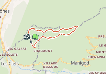

Length
6.7 km

Max alt
1531 m

Uphill gradient
457 m
Km-Effort
12.8 km

Min alt
1096 m

Downhill gradient
460 m
Boucle
Yes
Creation date :
2022-01-10 12:23:45.0
Updated on :
2022-01-10 12:23:46.91

FREE GPS app for hiking
 SityTrail
IGN / Geographical institutes
SityTrail Plus
The world is yours!
About
Trail of 6.7 km to be discovered at Auvergne-Rhône-Alpes, Upper Savoy, Les Clefs. This trail is proposed by dan69390.
Positioning
Country:
France
Region :
Auvergne-Rhône-Alpes
Department/Province :
Upper Savoy
Municipality :
Les Clefs
Location:
Unknown
Start:(Dec)
Start:(UTM)
293651 ; 5082910 (32T) N.
Comments